Mercury Laser RTK
Introduction
Product Parameter
Download
Relevant Industries
Recommend Product
Get Information
Introduction
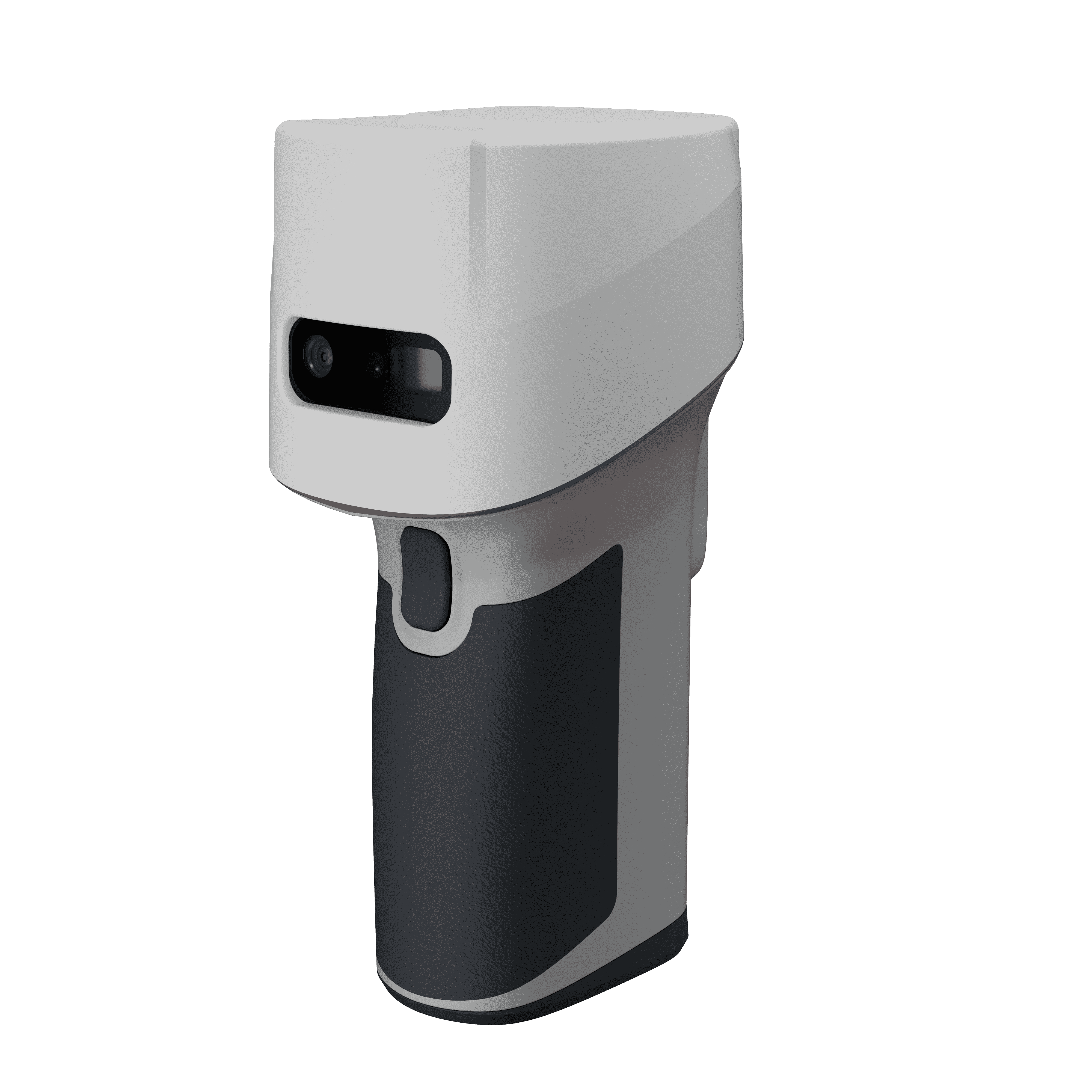
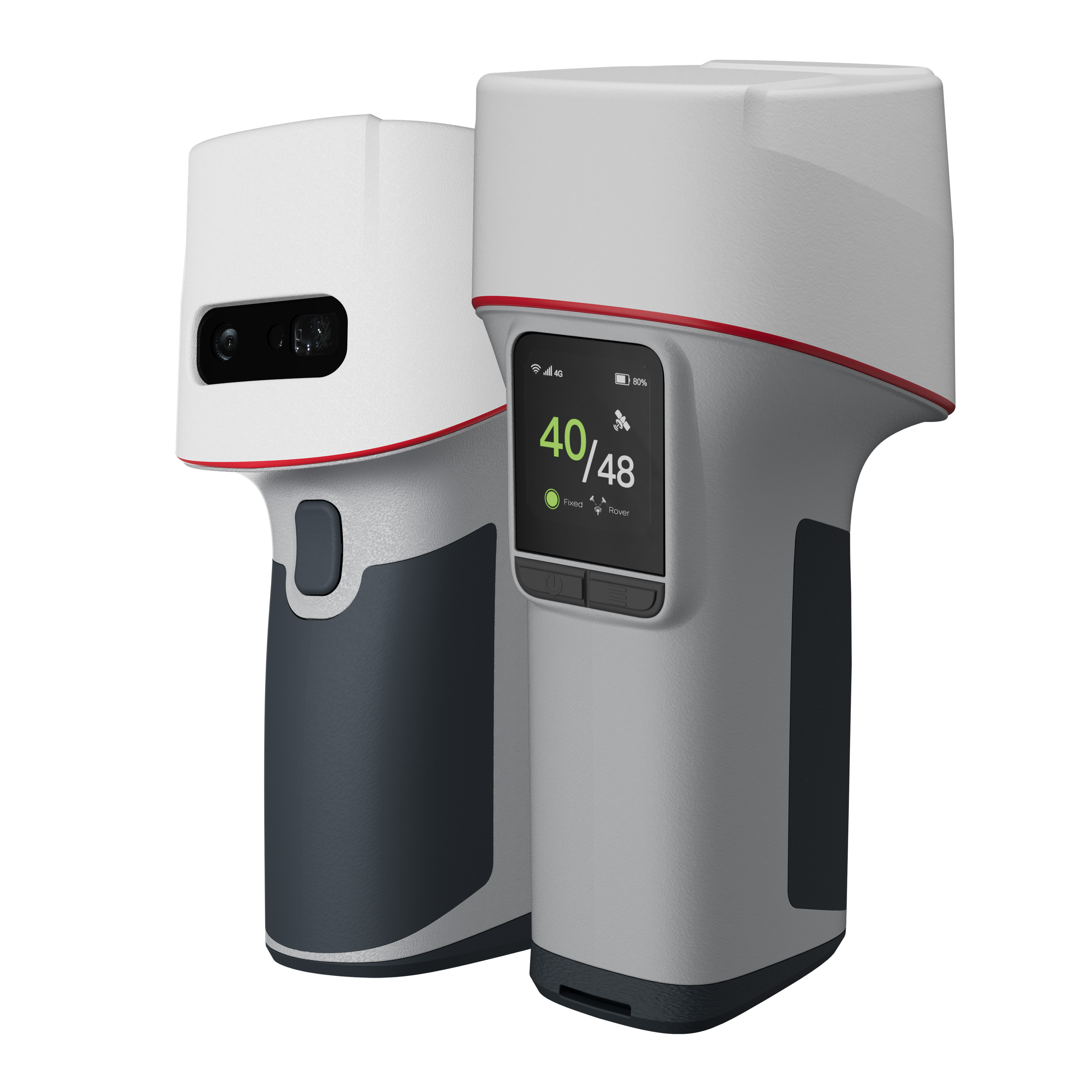
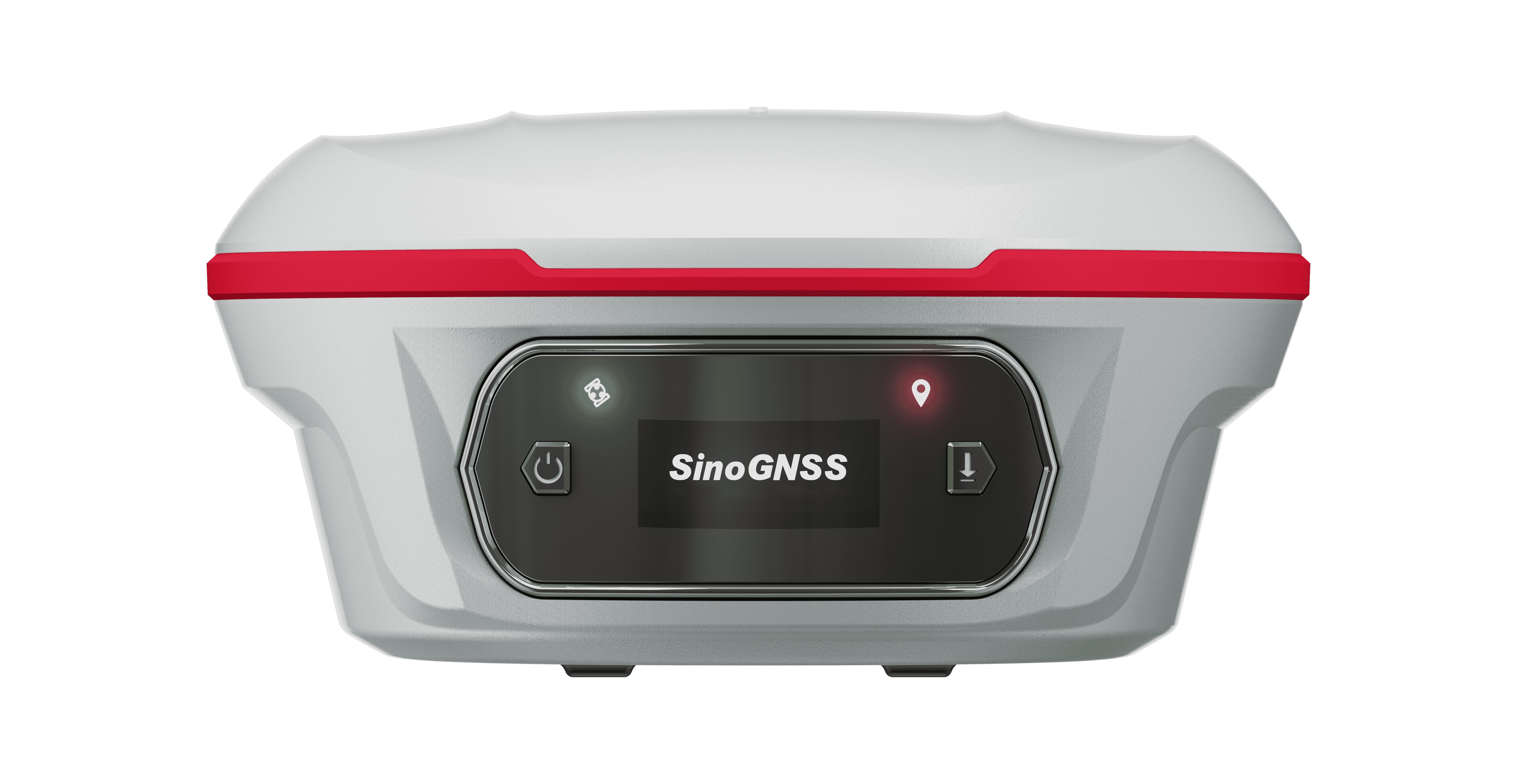
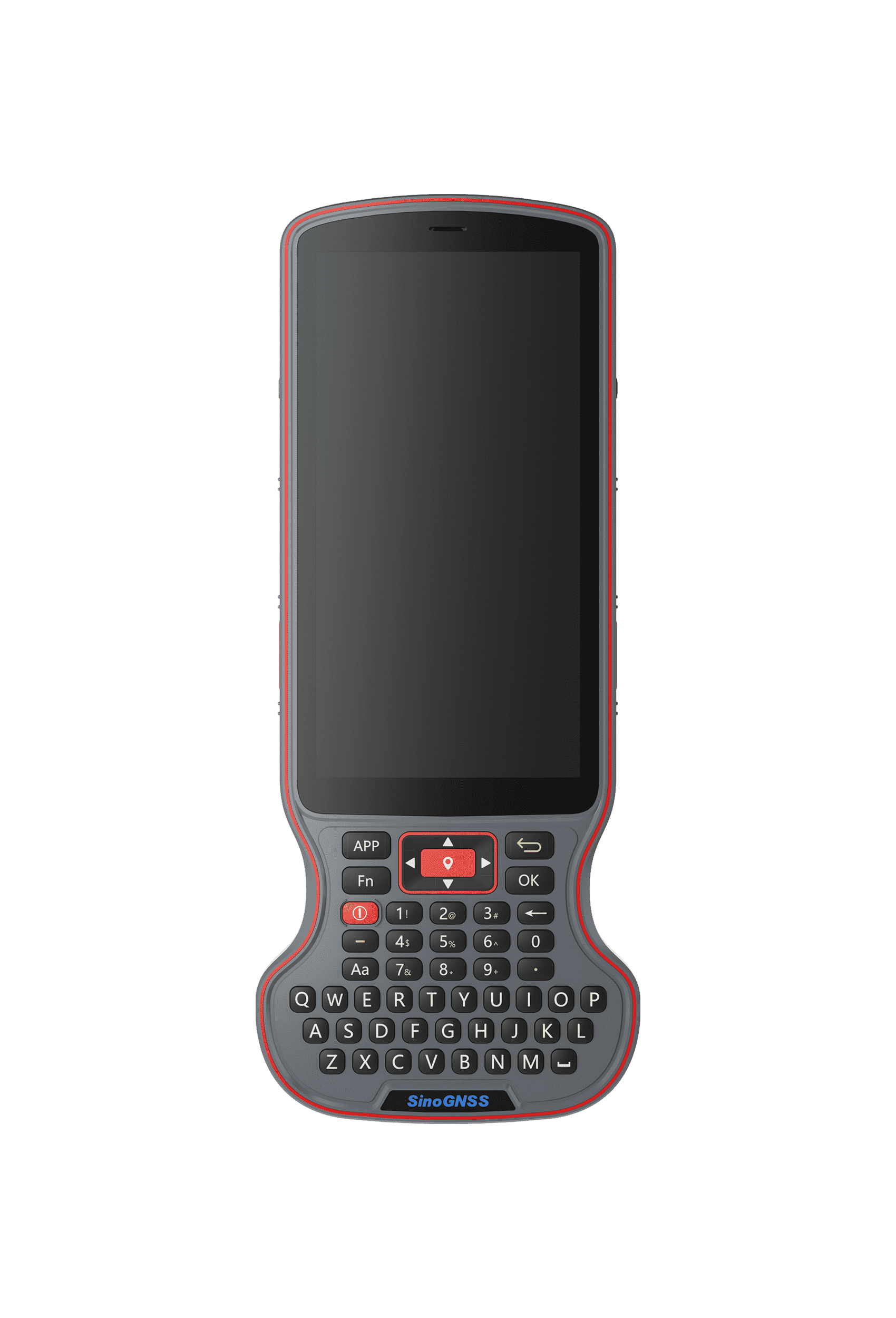
Mercury Laser RTK sets a new standard in surveying with true Pole-Free operation. Powered by the next-generation K9 chip and advanced IMU algorithms, it delivers high-precision measurements without a survey pole or controller, combining laser technology with real-time visualization. This all-in-one device integrates a high-performance geodetic antenna, long-range laser, and high-definition camera for accurate measurements up to 50 meters. Its ergonomic handheld design, touch-screen, and quick measurement button provide comfortable, efficient operation even in complex environments.


  • Precision Laser Measurement up to 50m
  • Long-focus Camera
  • Integrated Handheld Ergonomic Design
  • HD Touchscreen Display
  • Comprehensive 3D measurement
  • Real-time Visualization of Laser Points
  • Quick One-Tap Measurement
  • Multiple Measurement Experience
01
Laser Technology
The fusion of GNSS, IMU and laser technologies pushes working efficiency to the limits and ensures accuracy.
02
Full-Constellation & Multi-Frequency
With 1590 channels and 50+ satellite tracking capabilities, Mercury also supports PPP service. Getting fixed in seconds boosts your productivity.
03
Auto-IMU
Mercury is equipped with Auto-IMU, eliminating the need for manual initialization, supporting automatic calibration, and streamlining the operations in the field. It continues to support 120° compensation in conventional, laser and visual modes.
04
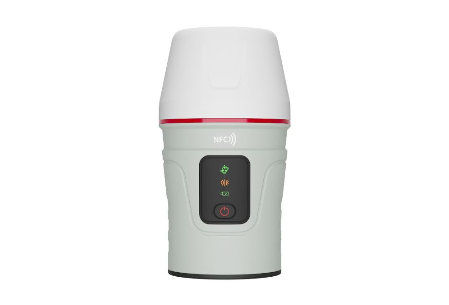
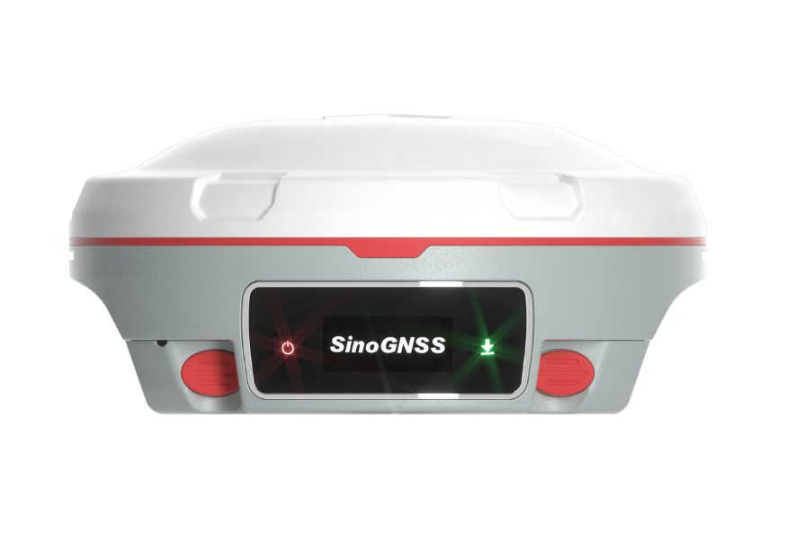
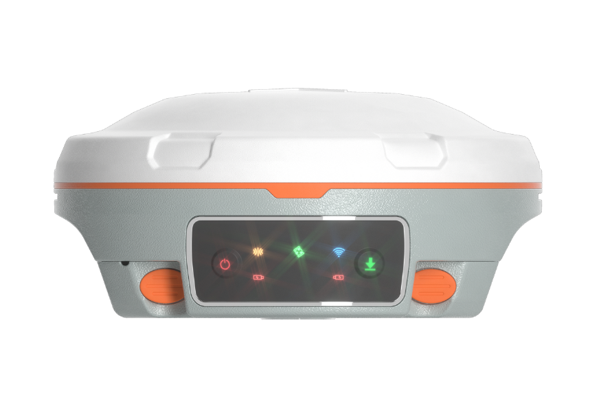
Handheld Design, Easy to Carry
Mercury is ergonomically designed for easy carrying. The GNSS receiver with sophisticated structure minimizes user fatigue.
05
Robust Design
Built to IP68 standards, Mercury is waterproof and dustproof, completely workable even in harsh environments.
06
Visual Stakeout
3D visual view on Survey Master software. By simply following the directional arrow and real-time distance, with the stakeout point marked directly on the ground.
Product Parameter
Performance
Physical
Communications
Laser
Camera
Performance
  • Channel
    1590
  • Satellites tracking
    GPS: L1C/A, L1C, L2P, L2C, L5
    BDS: B1l, B2l, B3l, B1C, B2a, B2b
    GLONASS: G1, G2, G3
    Galileo: E1, E5a, E5b, E6c, E5 AItBOC
    QZSS: L1C/A, L2C, L5, L1C
    IRNSS: L5
    SBAS: L1C/A
    PPP: B2b & HAS
    L-Band
  • Signal Re-acquisition
    ≤1s
  • Cold Start
    ≤30s
  • Hot start
    ≤10s
  • RTK Initialization Time
    <5s(Baseline≤10km)
  • Initialization Reliability
    ≥99.9%
  • Data Update Rate
    1Hz, 2Hz, 5Hz, 10Hz, 20Hz
  • Static and Fast Static
    Horizontal 2.5 mm + 0.5 ppm RMS
    Vertical 5 mm + 0.5 ppm RMS
  • Long Observations Static
    Horizontal 3.0 mm + 0.1 ppm
    Vertical 3.5 mm + 0.4 ppm
  • Single Baseline RTK
    Horizontal 8mm + 1ppm RMS
    Vertical 15mm + 1ppm RMS
  • DGPS
    <0.4m RMS
  • SBAS
    Horizontal 0.5m RMS
    Vertical 0.8m RMS
  • Standalone
    1.5m 3D RMS
  • Laser Tilt Measurement
    ≤3.5cm (5m range, ≤60°Tilt in laser mode)
Physical
  • Housing Material
    Aluminium magnesium alloy
  • Dimension
    Φ 8.1cm × 7.6cm × 17.1cm
  • Weight
    500g±50g with internal battery
  • Display
    1.1 inch OLED color display
  • Working Temperature
    -40 °C~+65°C (-72°F to 117°F)
  • Storage Temperature
    -40 °C~+85°C (-72°F to 153°F)
  • Humidity
    100% non-condensing
  • Water- & Dustproof
    IP68
  • Shock
    Survive a 1.5m drop onto the concrete
  • Voltage
    7.2V
  • Li-ion Battery Capacity
    5000mAh
  • Power Consumption
    1.8W
  • Working Time
    15h
  • Interface
    Type-C
  • Memory
    4GB

Communications
  • 1 Virtual Serial Port
    Baud rates up to 921,600 bps
  • WIFI
    802.11 a/b/g/n, 5GHz
  • Position data output rates
    1 Hz, 2 Hz, 5 Hz, 10 Hz, 20 Hz
  • Bluetooth
    V 4.0 protocol, compatible with Windows OS and Android OS
  • 4G Module
    B1/B3/B5/B7/B8/B20/B28
  • Auto-IMU integrated for tilt survey
    up to 120°tilt with 2.5 cm accuracy
  • Screen
    1.6-inch color touchscreen, providing intuitive data display and flexible work configuration
  • Correction Data I/O
    RTCM2.X, 3.X,CMR(GPSonly),CMR+(GPSonly)
  • Position Data Output
    - ASCII: NMEA-0183 GSV, RMC, HDT, GGA, GSA, ZDA, VTG, GST; PTNL, PJK; PTNL, PJK, GGK
    - ComNav Binary update to 20 Hz
Laser
  • Range
    50m
  • Laser Safety
    Class 3R
  • Accuracy (room temperature)
    (3-5)mm + 1ppm
  • Measuring Frequency
    Classic Value: 3Hz
    Maximum Value: 5Hz

Camera
  • Pixel size
    1600*1300
  • Field of view
    47°
  • Video frame rate
    30 fps
  • Image group capture
    - Rate: typically 2 Hz, up to 25Hz
    - Max. capture time: 60s with an image group size of appr. 60MB

Download
  • SinoGNSS Mercury Laser RTK_EN.pdf(1.74MB)
    2026-04-15
Relevant Industries
Recommend Product
Get Information

Product Name

Name *

Phone *

E-mail *

Company *

Country *

    Subscribe to Our Newsletter

    • No
    • Yes

    Inquiry Content *

    Captcha*