LS600 Laser Scanner
Introduction
Product Parameter
Download
Get Information
Introduction
The LS600 is a next-generation handheld 3D laser scanner that seamlessly combines advanced SLAM technology, a built-in RTK module for centimeter-level accuracy, and dual wide-angle cameras for vivid color capture. Through multi-sensor fusion (LiDAR, IMU, and camera), the LS600 achieves robust performance in both indoor and outdoor environments—delivering high-speed scanning, richly detailed color point clouds, and streamlined post-processing. Its lightweight, all-in-one design ensures efficiency and reliability across diverse industries, from surveying and urban renewal to mining and emergency response.


  • Equipped with dual 16MP cameras, capturing vivid color data. With V-SLAM, it generates detailed color point clouds
  • Powered by SinoGNSS's GNSS module, LS600 supports precise GNSS solutions, delivering centimeter-level performance
  • Features a built-in high-precision antenna, ensuring performance, supports pole connection for SLAM and RTK surveying
  • Integrates LiDAR, IMU, camera, and GNSS chip for reliable, high-precision performance in challenging environments
  • Supports backpack and extension pole kits, adapting to a wide range of environments—from urban surveying to mining exploration and beyond
  • Automated stitching, denoising, and rendering ensure efficient production of high-quality point clouds
01
Multi-Sensor Fusion and Environmental Adaptability
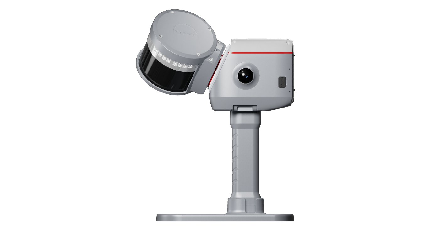
The LS600 integrates LiDAR, IMU, camera, and GNSS chip, ensuring stable performance in challenging environments like low-light, narrow spaces, or urban canyons. It supports backpack and extension pole kits, adapting to diverse scenarios from urban surveying to mining exploration.
02
High-Precision Multi-Mode Scanning
The LS600 offers 16-line or 32-line LiDAR configurations with a detection range of 120m or 300m, achieving scan rates of up to 320,000 points/sec (16-line) or 640,000 points/sec (32-line). Its built-in RTK module supports full-frequency GNSS, delivering centimeter-level accuracy, significantly enhancing field efficiency.
03
Dual-Lens Color Point Cloud Generation
Equipped with dual 16MP wide-angle cameras (190°×2 FOV), combined with visual-aided SLAM (V-SLAM), the LS600 generates high-precision, richly detailed color point clouds. It supports EDL mode to enhance edge clarity, providing more realistic visualization for in-depth data analysis.
04
Efficient Post-Processing with Flexible Coordinate Support
Featuring ScanMaster (Android) and RealEditor (PC) software, the LS600 supports automated stitching, denoising, and rendering, streamlining point cloud generation. It supports UTM, Gauss-Krüger, and other coordinate system projections, enabling direct, project-ready data output and seamless integration with GIS/CAD workflows, enhancing operational efficiency.
Product Parameter
Physical
Performance
Laser
Battery
Camera
Physical
Housing MaterialIndustrial-grade aluminum
Weight2.3 kg
Power Consumption<35w
Storage512GB SSD (expandable)
WirelessWIFI, Bluetooth
Software SupportScanMaster (mobile) / RealEditor (PC)
Operating Temperature–20°C to +50°C (–4°F to 122°F)
IP RatingIP54
Performance
GPSL1C/A, L1C, L2P, L2C, L5
BDSB1I, B2I, B3I, B1C, B2a, B2b
GLONASSL1, L2, L3
GalileoE1, E5a, E5b, E6c, E5 AltBOC
QZSSL1C/A, L2C, L5, L1C
IRNSSL5
SBASL1C/A
Absolute Vertical/Horizontal Accuracy (RMSE)3 cm
Real-time Relative Accuracy (RMSE)2 cm
Processed Relative Accuracy (RMSE)1 cm
Repeat Accuracy (RMSE)2 cm
Point Cloud Thickness (RMSE)≤ 0.5 cm
Horizontal/Vertical Angular Accuracy≤ 0.05°
Processing ModeReal-time + Post-processing
RTK Accuracy (Horizontal)8 mm + 1 ppm (RMS)
RTK Accuracy (Vertical)15 mm + 1 ppm (RMS)
Point Cloud Format.las
Image Format.jpg
TurboCloud EnhanceSupported
Laser
Laser ClassClass 1 / 905 nm
Number of Lines16 / 32
Field of View360° × 270°
Range0.5–120 m / 0.5–300 m (4 configurations)
Scan Rate16 lines: 320,000 pts/s
32 lines: 640,000 pts/s
Battery
TypeLi-ion battery
Voltage14.4 V
Capacity48.24wh
Typical Operating Time1.5 hours
Camera
Number of Cameras2
Camera Resolution16 MP × 2
FOV190°×190°
Download
  • SinoGNSS LS600 Laser Scanner.pdf(2.09MB)
    2025-03-19
Get Information

Product Name

Name *

Phone *

E-mail *

Company

Country *

    Subscribe to Our Newsletter

    • No
    • Yes

    Inquiry Content

    Captcha*