PPP+IMU Technology for Vehicle Navigation
1 Free PPP-HAS/B2b Positioning
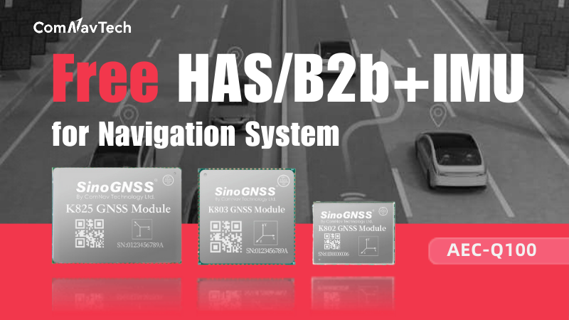
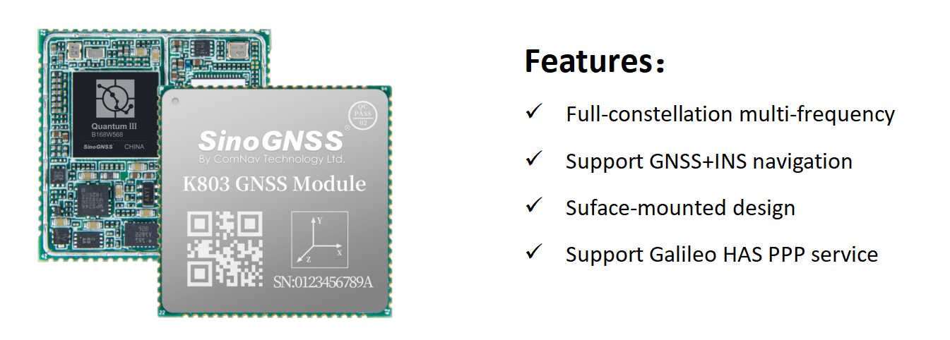
ComNav proudly offers free PPP-HAS/B2B services, with its K8 series OEM boards providing significant cost savings for customers, while achieving a horizontal positioning accuracy of up to 20cm. In the two years since its launch, this technology has gained wide recognition in the market, delivering high-precision positioning solutions to clients.
Precise Point Positioning (PPP) is a high-precision technology based on a single GNSS receiver. Unlike differential positioning methods such as RTK, PPP does not require any local infrastructure, such as continuously operating reference stations.
2 What Challenge PPP Positioning Face?
However, single PPP technology faces challenges in scenarios involving signal blockage or interruption. During signal obstruction, the system must re-converge, which typically takes a considerable amount of time to return to a high-precision state.
To address this issue, ComNav’s R&D team introduced Inertial Measurement Unit (IMU) technology. The IMU can operate independently without relying on external signals, allowing it to provide stable navigation information even in signal-restricted environments, such as tunnels or underground settings, although its navigation errors may increase over time.
3 Solution: PPP + IMU Integration
PPP achieves high-precision positioning through satellite signals, while IMUs ensure navigation continuity during brief signal interruptions. The combination of PPP and IMU effectively leverages the strengths of both technologies; in cases of GNSS signal loss, the INS assistance not only maintains a continuous positioning trajectory but also accelerates the convergence of PPP when the signal is restored.
This combined approach demonstrates significant potential in open environments, such as highways and remote areas, ensuring positioning accuracy while greatly enhancing system adaptability and stability in complex conditions.

4 Dynamic Test
We conducted tests using the K803 board with the PPP+IMU combination navigation, and the results showed that this integrated solution provides continuous positioning trajectories. It can seamlessly switch to inertial guidance during periods of poor satellite signal or sudden interruption, thereby offering a more reliable level of positioning, and it can quickly return to the correct location after passing through a tunnel.
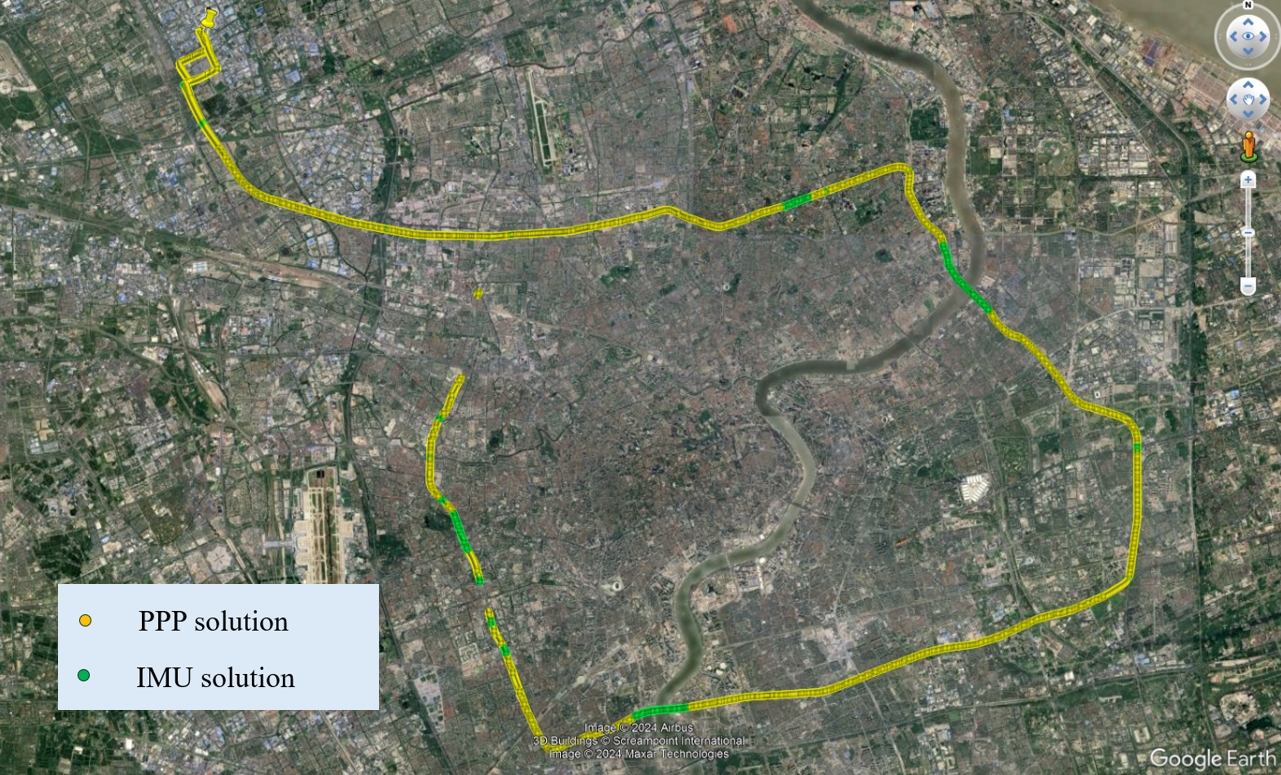
Fig. Test Path Diagram, the Trajectory in the Diagram is the Position Data Recorded by the K803 Board
a. Open Environment

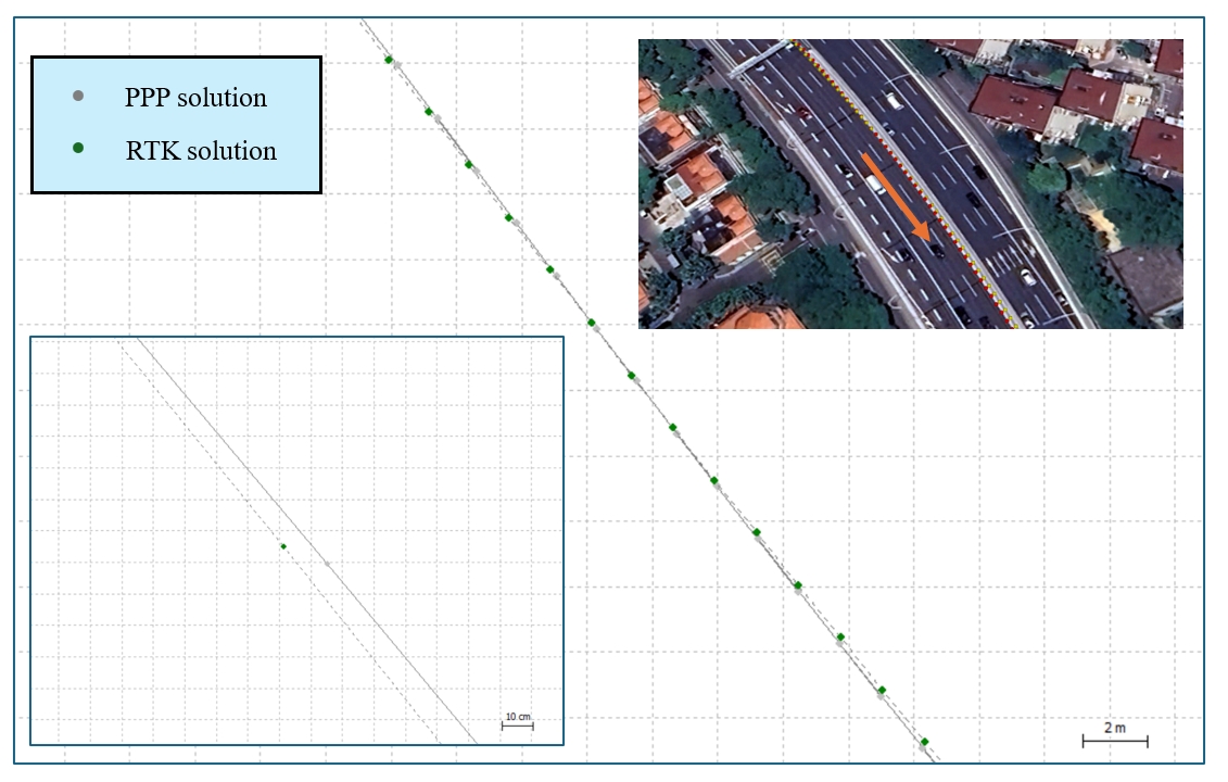
In open environments, the PPP-HAS/B2b shows great performance. After PPP ponvergence complete, it can keep stable PPP solution status, and compared with real time RTK result, the PPP accuracy in open sky is around 10cm.
b. Across Temporary Obstructions
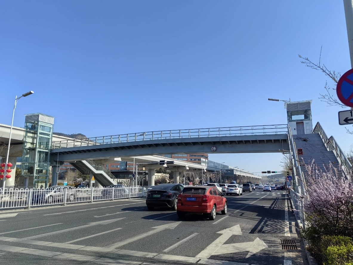
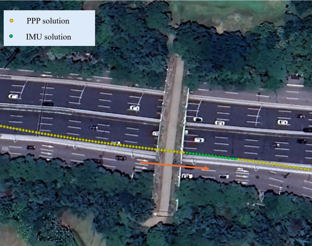
When a vehicle passes under brief obstructions like overpasses, satellite signals are momentarily lost. In such cases, it quickly switches to IMU positioning to maintain a continuous trajectory. Since the transit time is short, the IMU positioning error remains minimal before PPP positioning resumes, ensuring continuous and accurate positioning.
c. Across City Canyon


In densely built urban areas, severe signal obstruction can easily cause PPP to exit its converged state and enter a state of re-convergence. In this situation, while the accuracy of PPP may decrease, it can still maintain continuous and smooth positioning output.
d. Across the Tunnels

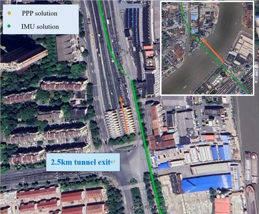
After entering a tunnel, the vehicle's positioning will switch to IMU navigation due to the loss of GNSS signals, ensuring trajectory continuity. However, since the accuracy of the IMU can diverge over time, the longer the tunnel, the greater the positional offset that occurs. The figure above shows that after the vehicle passes through a 2.5 km tunnel, there is a certain degree of positional shift, which is expected. Additionally, we can see that when the GNSS signal is restored, PPP is able to return to a relatively accurate position, which is a promising outcome.
About ComNav Technology
ComNav Technology develops and manufactures GNSS OEM boards and receivers for high precision positioning demanded applications. Its technology already been used in a wide range of applications such as surveying, construction, machine control, agriculture, intelligent transportation, precise timing, deformation monitoring, unmanned system. With a team dedicated for the GNSS technology, ComNav Technology is trying its best to supply reliable and competitive products to worldwide customers. ComNav Technology has been listed on the Shanghai Stock Exchange (Science and Technology Board), securities :ComNav Technology (Compass Navigation), Stock code: 688592.
About SinoGNSS®
SinoGNSS® is the official trademark of ComNav Technology Ltd., registered in People's Republic of China, EU, USA and Canada. All other trademarks are the property of their respective owners.
About ComNavTech®
ComNavTech® is the official trademark of ComNav Technology Ltd., registered in People's Republic of China, EU, USA and Canada. All other trademarks are the property of their respective owners.
