
Precision Monitoring: ComNav’s GNSS Technology Safeguards Critical Cambodian Hydropower Dam
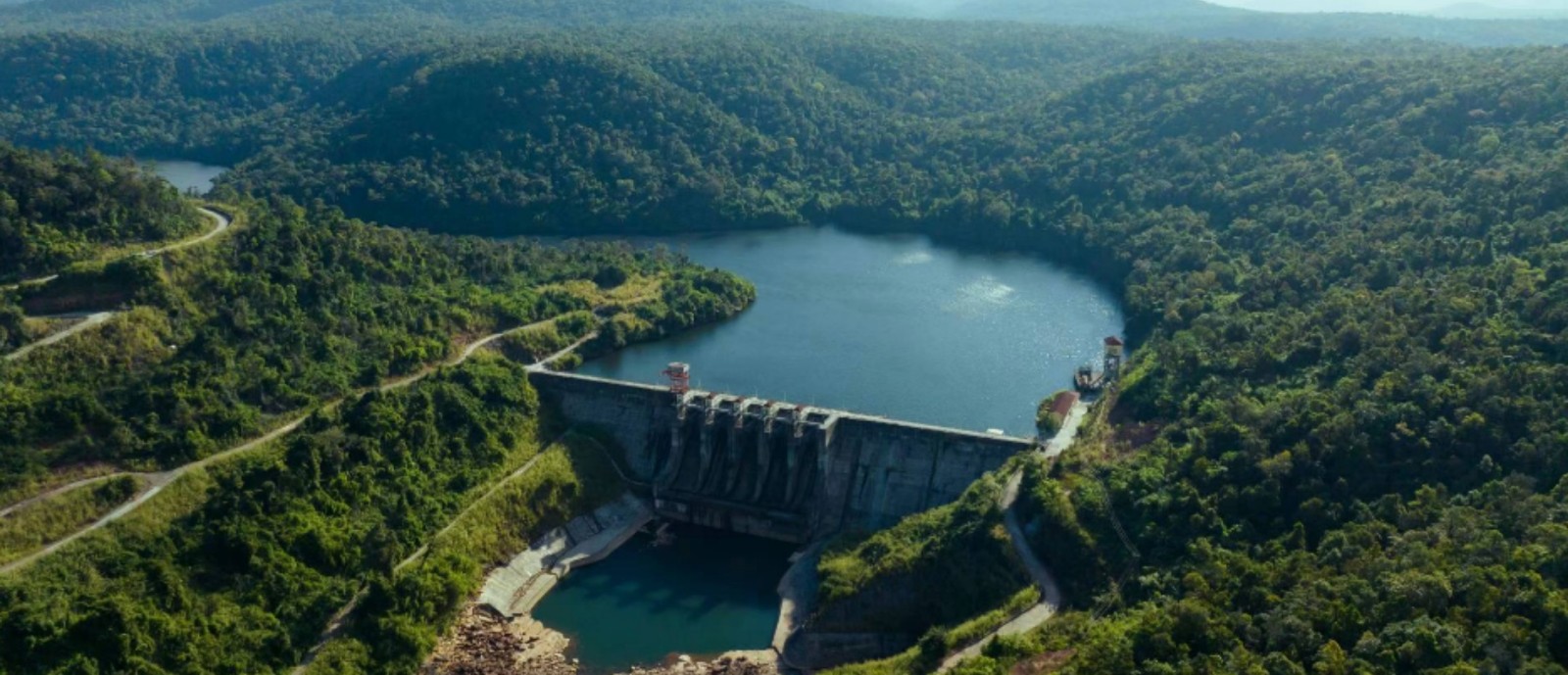
ComNav Technology Ltd., a global leader in high-precision GNSS solutions, has successfully deployed an advanced dam safety monitoring system for a major Cambodian hydropower station. The project leverages ComNav's innovative GNSS technology to ensure the structural integrity of this critical infrastructure.
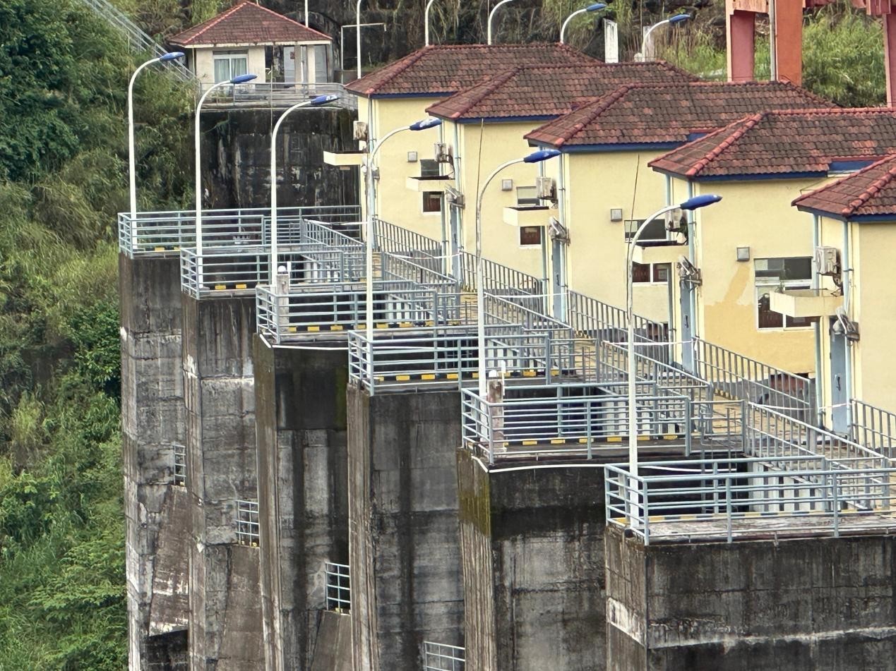
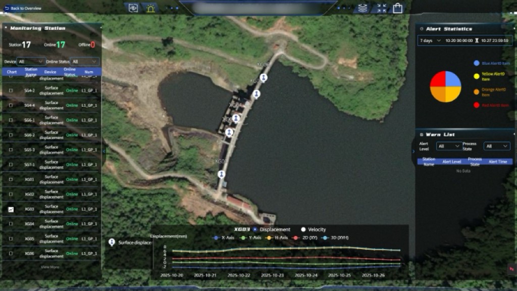
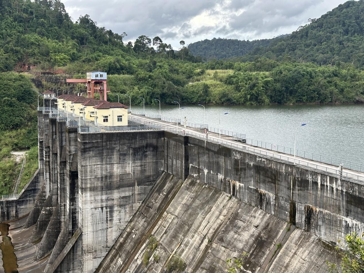
Initiated in February 2025 and commencing full operation by August 2025 after rigorous testing and optimization, the system integrates ComNav's M300 Pro GNSS receiver and A300 GNSS receiver to provide continuous, millimeter-level displacement monitoring. This comprehensive solution networks 4 reference stations and 17 monitoring stations across the dam's upper and lower sections, representing a significant technological leap over traditional manual methods and enabling proactive safety management through real-time data.
Safeguarding a Key Energy Asset in Cambodia
As a major Build-Operate-Transfer (BOT) project, this hydropower station is critical to Cambodia's energy supply, supporting regional economic growth and stability. Ensuring the dam's safe and reliable operation is paramount. Traditional monitoring methods, often reliant on manual inspections, are not only time-consuming and labor-intensive but also struggle to provide the continuous, high-precision data required for early warning of potential hazards such as foundation settlement, structural deformation, and slope instability. Given these risks, along with its complex structure and location in a tropical climate zone with heavy rainfall, the dam requires a robust, all-weather monitoring system capable of detecting subtle structural deformations with high precision and reliability.
An Innovative, All-Weather Monitoring Solution
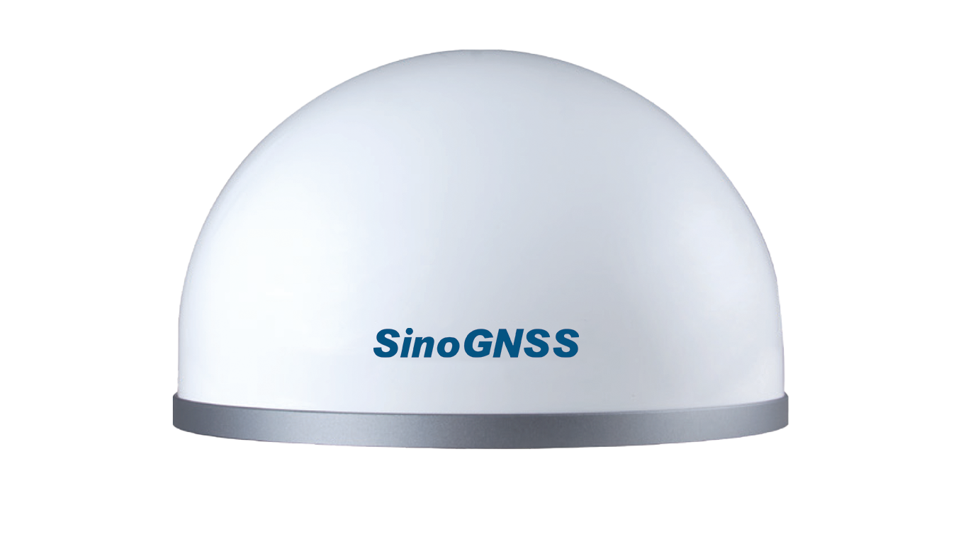
ComNav's solution addresses these challenges with a system built upon GNSS technology, providing millimeter-level precision and synchronized data analysis for reliable real-time monitoring. The core of the system involves the rugged A300 GNSS receiver deployed at strategic points on the dam. The A300, known for its compact, integrated receiver-antenna design, reduces onsite device footprint and installation complexity while enhancing safety. The system is engineered for resilience, featuring commercial power supply with protective conduits, a hybrid communication network of fiber optics and wireless bridges that serves as a redundant backup channel, ensuring data transmission even if one link fails, and a comprehensive multi-layer lightning protection system.
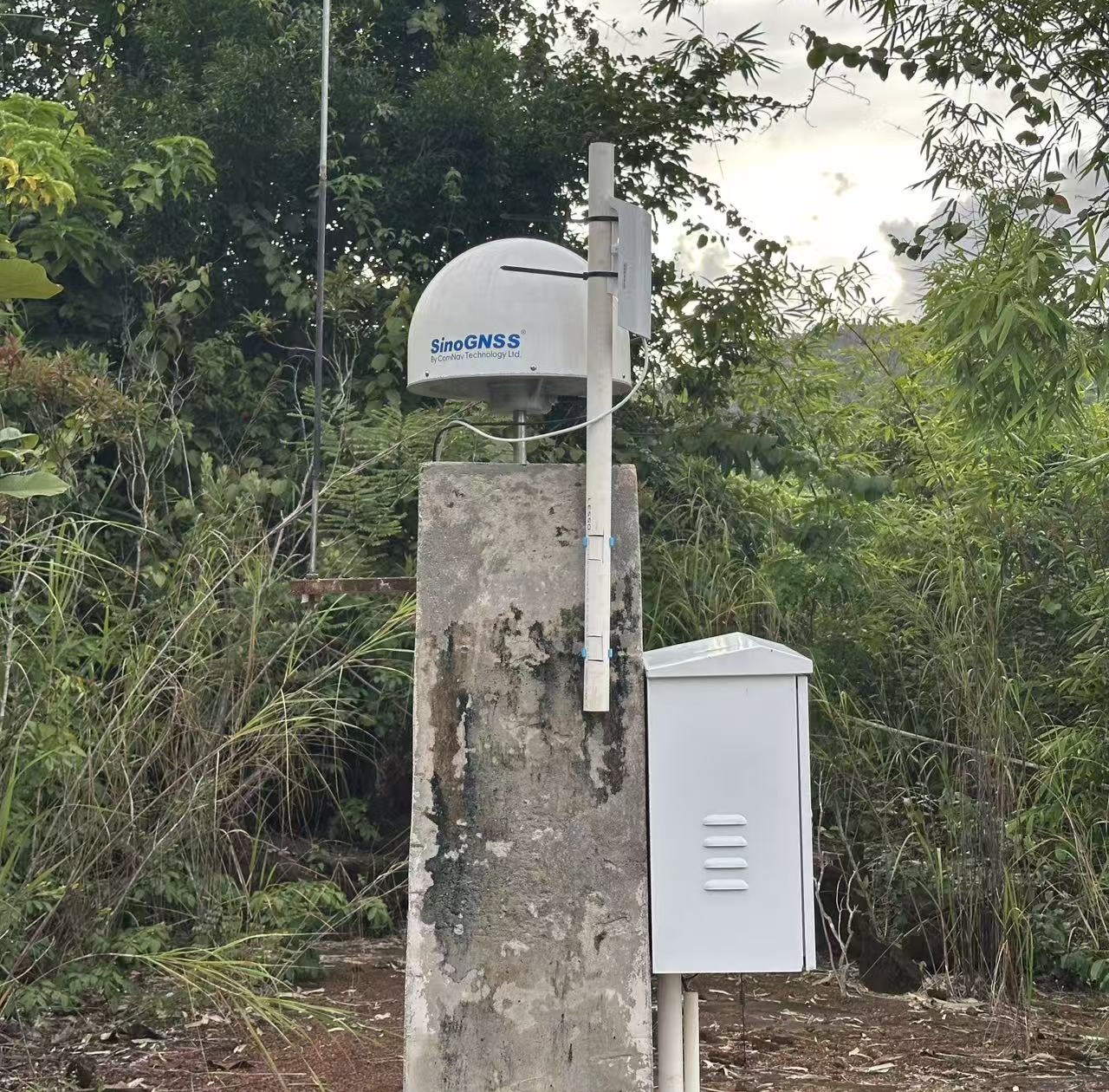
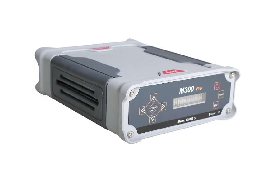
Data from the A300 GNSS Receiver is collected and managed by the high-performance M300 Pro GNSS receiver, which serves as a reliable reference station and communication hub. The M300 Pro features a robust aluminum housing, long-endurance battery backup, and support for multiple data transmission protocols, ensuring continuous and stable data flow.
All monitoring data is transmitted in real-time to ComNav's proprietary CDMonitor software platform and an integrated monitoring portal. The software provides intuitive data visualization, automatic threshold alerts via pop-up, SMS, or email, and remote device management capabilities, allowing engineers to monitor system health and modify parameters from a central control center.
Enhancing Safety with Real-Time Insight and Reliability
The deployment of ComNav's monitoring system has significantly improved dam safety management for Cambodia. It enables 24/7 automated surveillance, replacing risky and inefficient manual inspections. The system's performance is demonstrated by an exceptional 100% online rate and highly stable data readings. For instance, the cumulative displacement at all 17 monitoring points has retained within a minimal range of 0.57mm to 2.49mm throughout the operational period, with no alerts triggered, confirming the dam's structural integrity.
This shift from periodic, manual inspections to continuous, data-driven monitoring enables the operational team to make more precise, informed decisions. This advancement not only ensures the dam's long-term safety and operational reliability—protecting downstream communities and the environment—but also enhances maintenance planning and resource allocation efficiency. The project highlights the successful integration of advanced GNSS technology in infrastructure development, demonstrating how innovation drives practical, sustainable improvements that support the growth and resilience of Cambodia's critical energy infrastructure.
"We are proud that our high-precision GNSS technology is helping to ensure the safety and sustainability of critical infrastructure," said a project manager at ComNav Technology. "The success of this project, from deployment to data validation, underscores the reliability of our integrated monitoring solution, highlighting our commitment to providing innovative, life-saving technologies to global markets."
About ComNav Technology
ComNav Technology develops and manufactures GNSS OEM boards and receivers for high precision positioning demanded applications. Its technology already been used in a wide range of applications such as surveying, construction, machine control, agriculture, intelligent transportation, precise timing, deformation monitoring, unmanned system. With a team dedicated for the GNSS technology, ComNav Technology is trying its best to supply reliable and competitive products to worldwide customers. ComNav Technology has been listed on the Shanghai Stock Exchange (Science and Technology Board), securities :ComNav Technology (Compass Navigation), Stock code: 688592.
About SinoGNSS®
SinoGNSS® is the official trademark of ComNav Technology Ltd., registered in People's Republic of China, EU, USA and Canada. All other trademarks are the property of their respective owners.
About ComNavTech®
ComNavTech® is the official trademark of ComNav Technology Ltd., registered in People's Republic of China, EU, USA and Canada. All other trademarks are the property of their respective owners.