A successful GIS project with P8H in Japan — Forest Survey
1 Project Overview
For a forest area, it is necessary to map the boundaries of the area, and measure and record information such as the longitude and latitude coordinates of the trees in the area, tree species, tree height, diameter at breast height, tree age, whether there are pests and diseases, and whether they can be cut down. It is difficult to obtain high-resolution images using traditional remote sensing images, and the specific information of each tree needs to be recorded manually. If high-precision RTK equipment is used, it is difficult to get fixed solution because of dense forests, and it is difficult to walk on forest roads and difficult to carry the equipment. In fact, forest operations do not require such high precision.
Therefore, the combination of P8H and laser rangefinder allows forest survey work to be carried out smoothly.
2 Application Requirement
3 Challenges
4 Benefit
5 Project Summary

Fig. Site environment
Date
Field work was conducted from 16th May to 30th May
Office work was conducted from 3rd June to 7th June
Location
Instruments
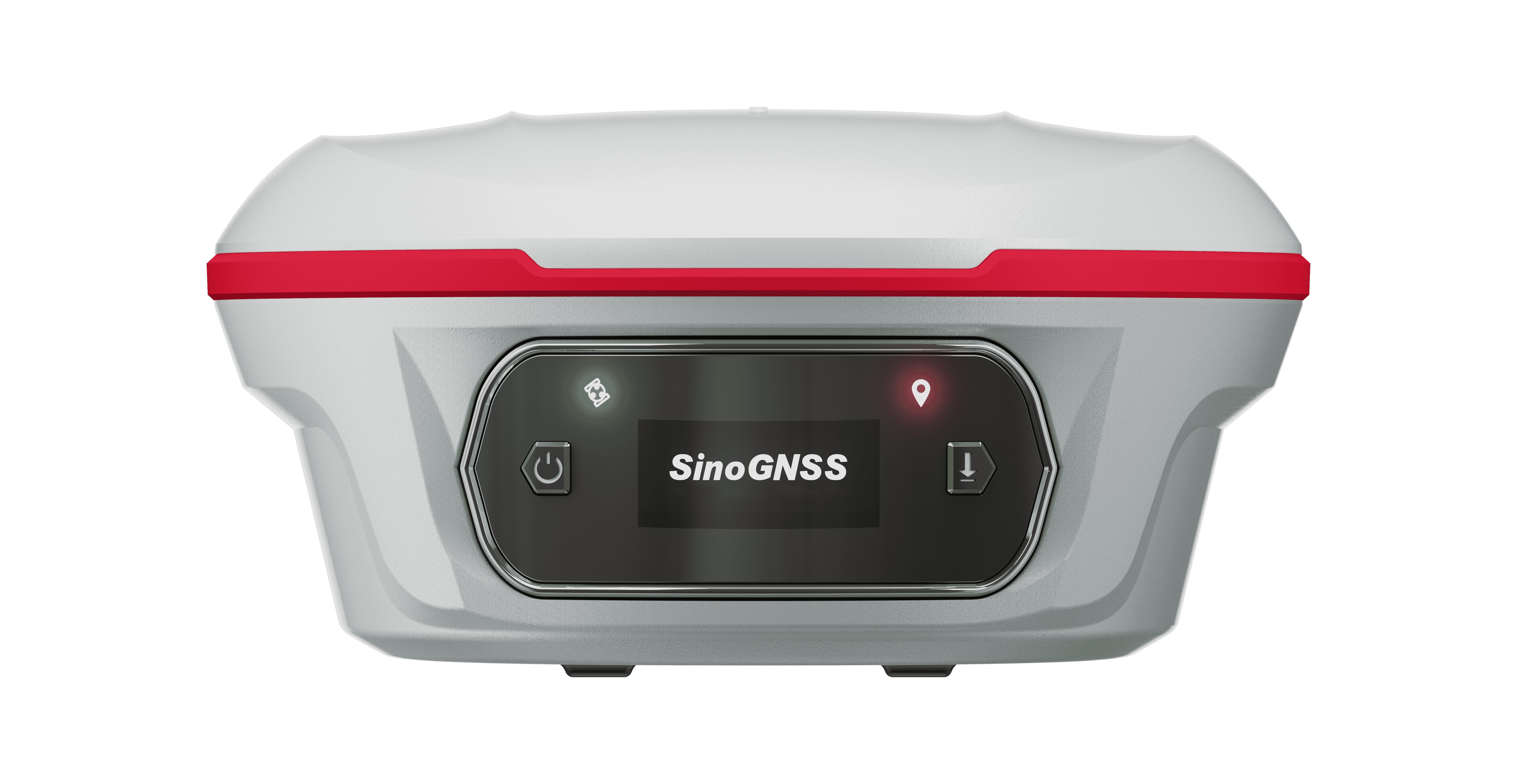
1X P8H
1X TruPulse 360R
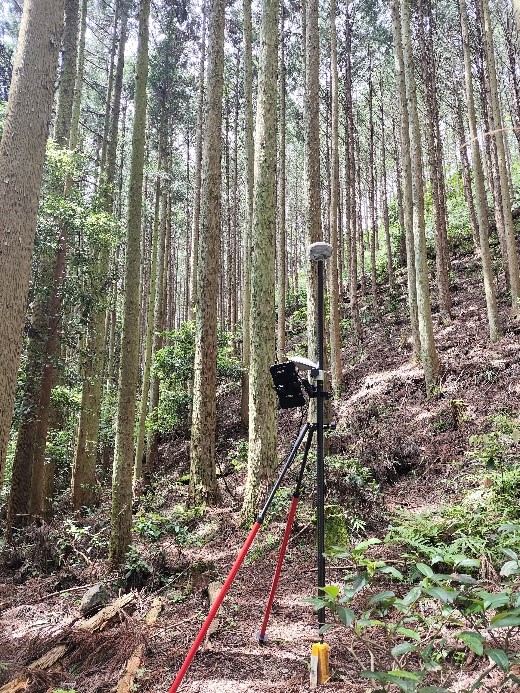
Fig. P8H used in the forest
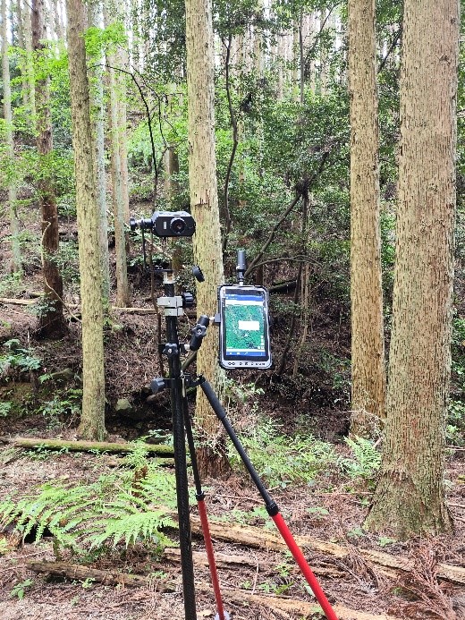
Fig. TruPulse 360R used in the forest
Software
Location Tools
GNSS mapper
Procedure
✓ Equipment portability
Traditional forest survey needs to carry equipment such as receiver, ruler, tape measure, tripod, level, notebook, etc. The equipment is inconvenient to carry, and the measurement work is difficult to carry out. The combination of P8H and laser measuring equipment reduces the carrying pressure of the equipment. The P8H can be fixed to the centering rod through a bracket or can be measured hand-held with a wristband, both of which make the selection and measurement easier.
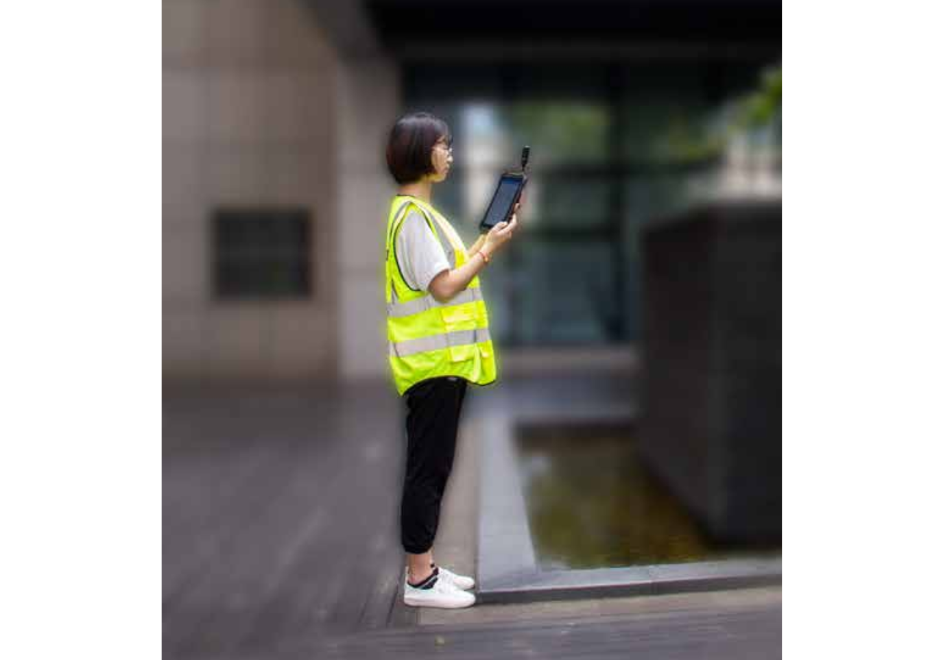
Fig. Hand held P8H

Fig. Use a bracket to fix P8H
✓ Obtain the exact coordinates of the objects
Access differential data in the forest
In traditional GIS measurement, ground objects may be located through remote sensing images or single point solution of equipment, which makes it impossible to obtain accurate coordinates and easily cause coordinate errors of measurement points. In this scheme, we use P8H built-in high-precision GNSS board, by connecting CORS differential data, to obtain the exact coordinates of the current equipment.
CORS stands for Continuous Operating Reference Stations. CORS is a network of ground survey sites specifically set up and operated by Geographic Information Systems (GIS), designed to provide high-precision Global Navigation Satellite System (GNSS) location information. The stations are equipped with GNSS receivers that continuously pick up satellite signals and record the data they receive. This data can be used to perform geodetic surveys to correct the position of GNSS receivers and provide high-precision location information for geographic data. Through the CORS network, users can obtain accurate geographic coordinates, so as to obtain more accurate results in applications such as GIS surveying and map making.
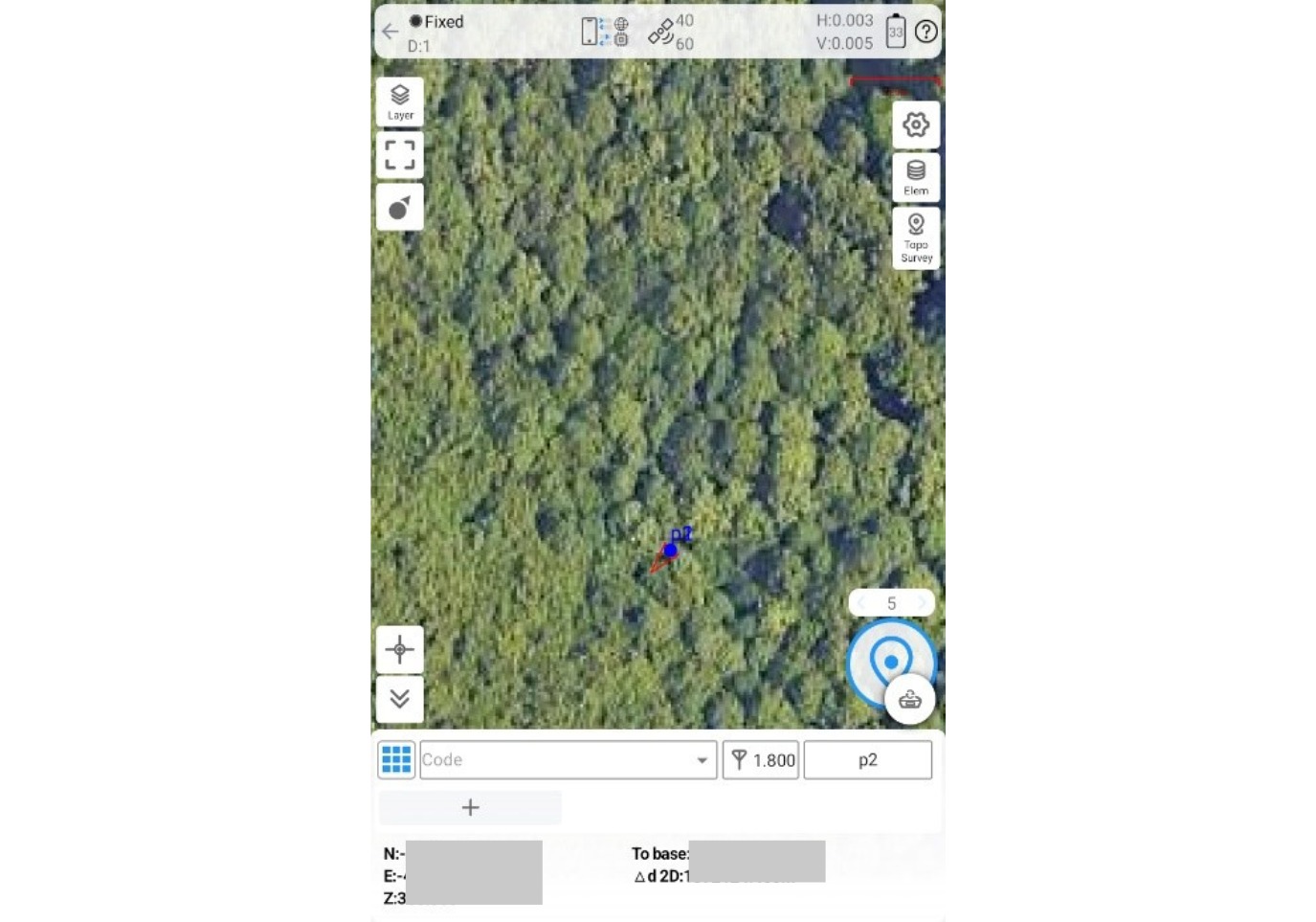
Fig. P8H fixed in the forest environment
Obtain high-precision ground object coordinates using the SBAS function
In the area without CORS network coverage in the forest, the area with poor 4G signal and the area with severe occlusion in the forest, it is difficult to use CORS to solve the high-precision coordinates. SBAS stands for Satellite-Based Augmentation System (SBAS). It is a technology used to enhance the performance of satellite navigation systems such as the Global Navigation Satellite System (GNSS). The SBAS system receives the GNSS signal through the ground monitoring station and transmits the relevant information back to the ground processing center. The processing center then uses this information to calculate and correct errors in the GPS signal, and then re-broadcast the corrected signal to the user's receiver via the ground station. This correction can improve the accuracy and reliability of GNSS positioning, especially in cities, mountains, forests and other sheltered environments, as well as in the case of brief signal interruption. The purpose of the SBAS system is to provide more accurate and reliable position information to meet various measurement accuracy requirements.
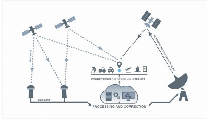
Fig. SBAS Schematic Diagram
Using the SBAS function of P8H in the forest interior, reliable ground object coordinates can also be obtained. The existing test and customer's actual use results show that the SBAS accuracy of P8H can reach 0.5 m RMS, which meets the GIS measurement accuracy requirements.
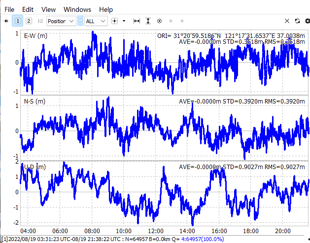
Fig. SBAS test using Japan-MSAS
✓ Laser measuring instrument supports object measurement in visual range
The laser measuring instrument is set up at the origin, and the distance, Angle and other information can be obtained by moving the azimuth. The measured data can also be displayed on the P8H through Bluetooth real-time transmission, click OK to save the data, and the measurement task is more efficient, even if a person can complete the measurement.
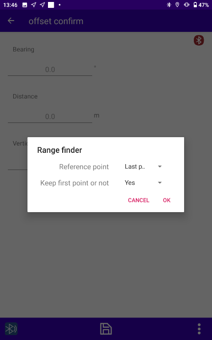
Fig. Rangefinder measurement setting menu
✓ Simple software operation flow
Get position by Mock Location & Location Tools
Since customers have many applications for forest surveys and their application requirements are relatively simple and unified, customers use their own GIS measurement software. But the software cannot connect to the board, so we provide another function. That is, mock location, which shares the high-precision positioning of the board with other software. For the location sharing function, we also provide two options. One is to use the mock location function of Survey Master software. The other is to develop Location Tools software with simpler functions and more intuitive operations. The software starts up and connects directly to the board. After connecting to the CORS service, the software automatically shares the current coordinates. The GNSS Map software obtains positioning data through the shared location.
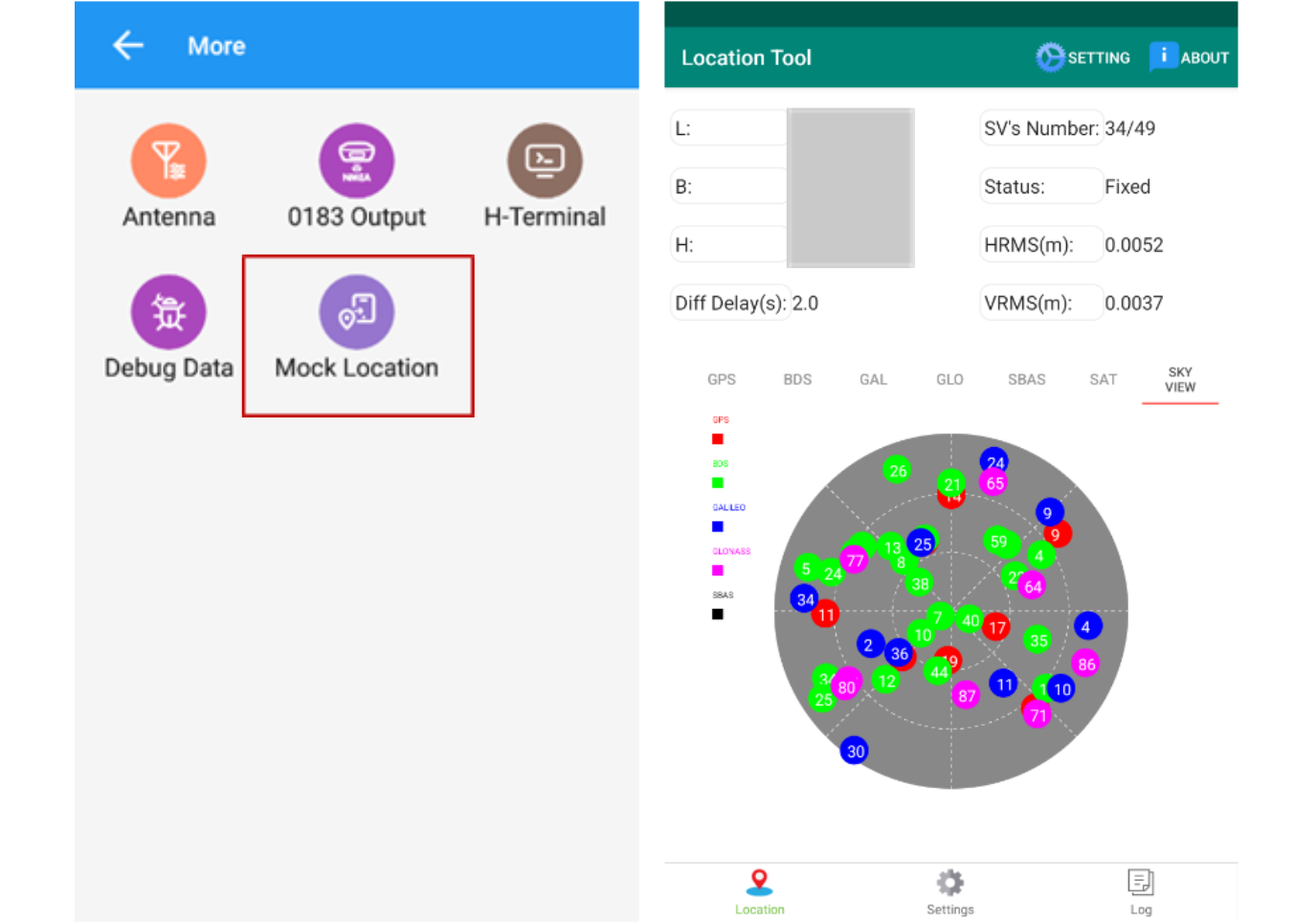
Fig. Mock location function in Survey Master and Location Tools software
Collect data by GNSS mapper
The software supports the input of data in SHP and GeoJson formats. It can input layer data such as regional boundary maps. It supports the input of CSV data and can import predefined attribute values. During the measurement process, different icons can be set for different elements, making it easy to distinguish different features, which improves the visualization level of the measurement interface. When measuring points, you can edit feature attributes at the same time, or click on features to quickly view the relevant attributes of the features. The attribute values are intuitively visible, making it easy to check and modify.
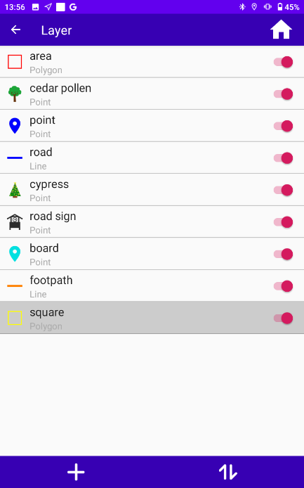
Fig. Set different icons for different features
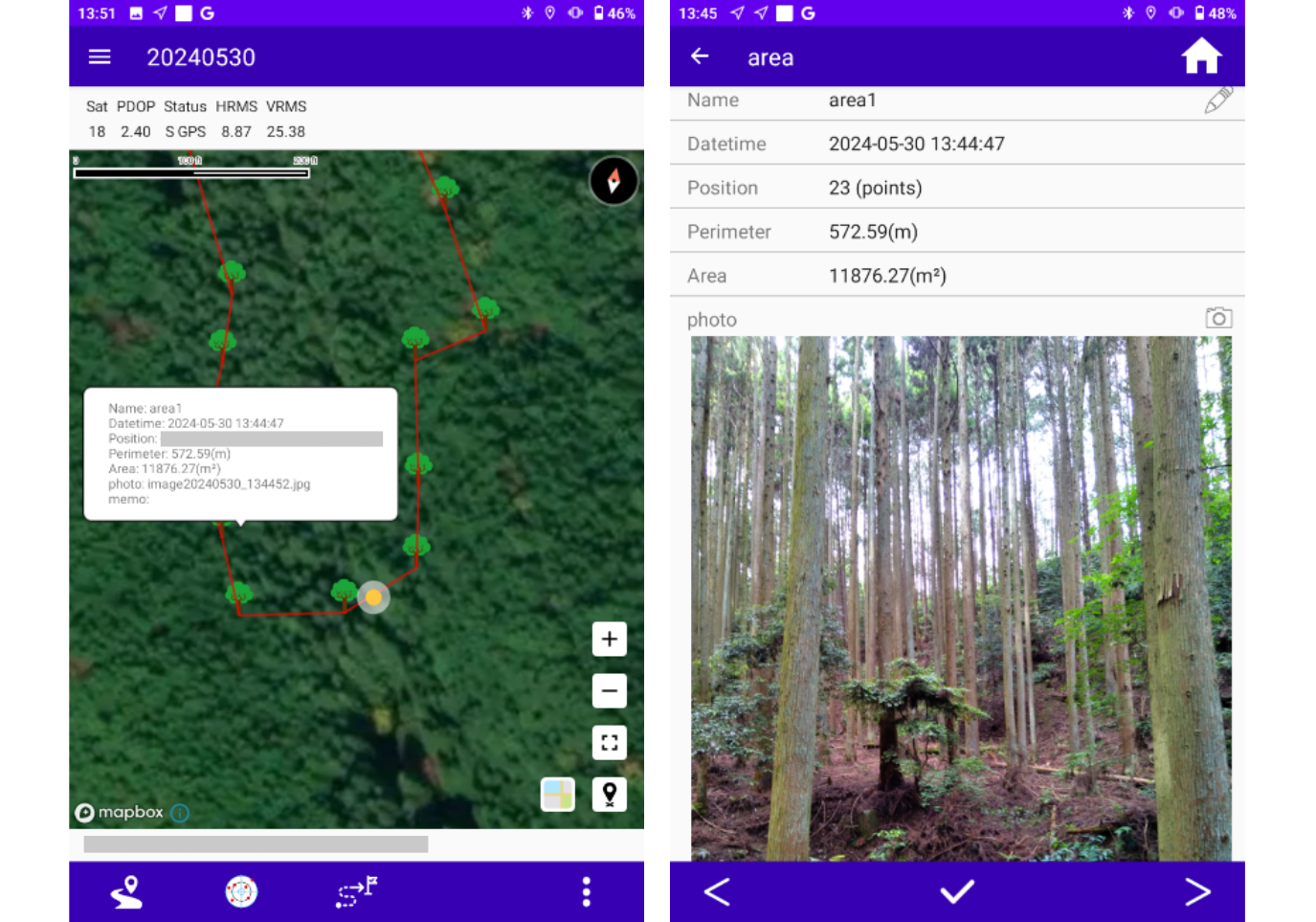
Fig. Measurement interface information display
✓ Measurement results support a variety of data analysis methods
6 Result
The project completed the geographical location and property measurement of tens of thousands of trees in a forest area of nearly 12,000 m2 within two weeks. The precise division of forest area boundary was completed. The purpose of detailed record and update of the property of the trees and roads in the area meets the work requirements of forest survey. Improve the efficiency of large area measurement and data analysis in harsh environments.
Due to the principle of data confidentiality, the data result graph cannot be disclosed for the time being. Only the data results in csv format are displayed. All coordinate information is omitted from this article.
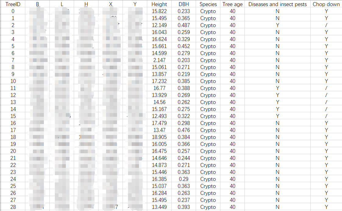
Fig. Result photo
7 Another data collection method
Customer can also use Survey Master to collect GIS data. P8H comes with Survey Master software, which has powerful GIS measurement functions. The software can directly connect to the board and set up the CORS differential data connection.
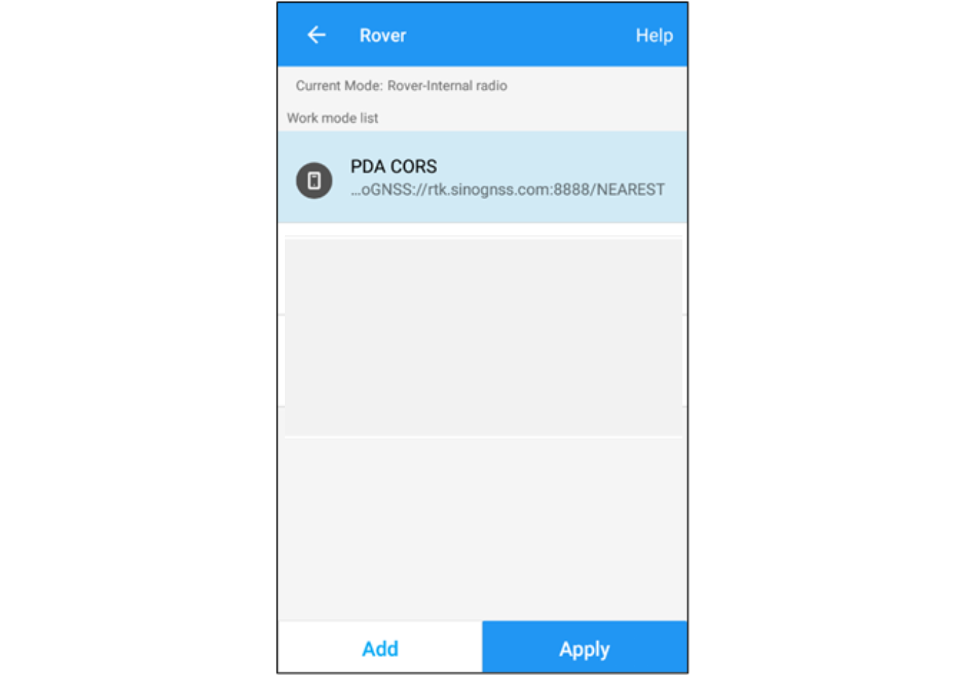
Fig. Apply work mode in Survey Master
The Code list function can set attribute parameters in different formats for the features to be measured, including Text, Yes/No, Integers and Decimals, etc. It can also set different colors and sizes for different features according to needs.
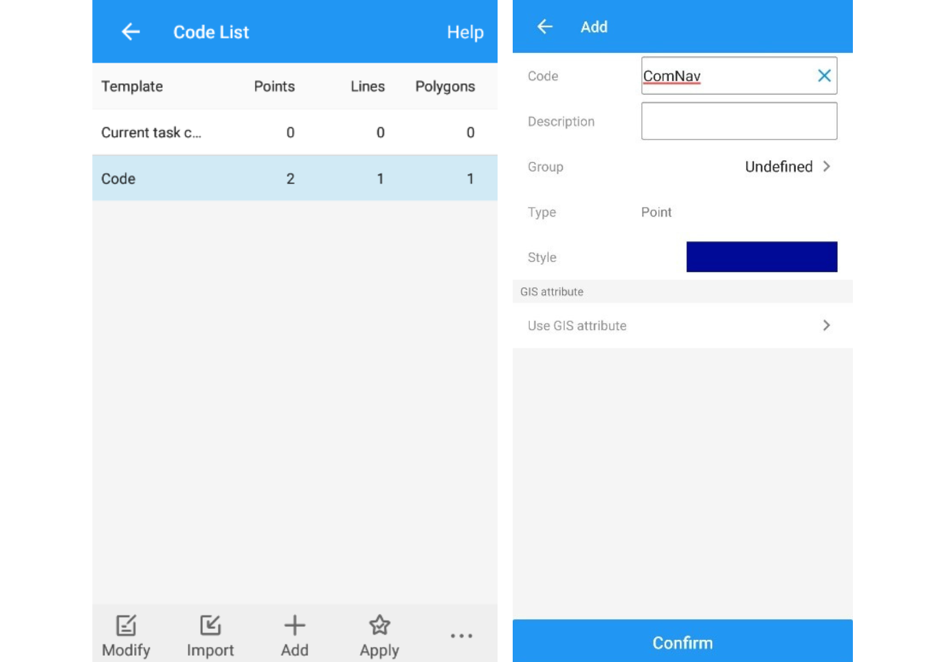
Fig. Code list setting
Different layers can be imported during GIS measurement. Topographic maps, Contour maps, DEM data, etc. can be imported according to needs to enrich measurement layer information and make GIS measurement more visual. By adding nine panels to the Feature Survey interface, you can quickly select the types of features to be measured and complete the measurement to assign values to the features' attributes.
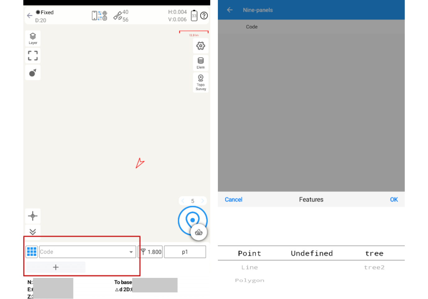
Fig. Add codes in nine panel
After the measurement is completed, the results can also be exported to a variety of formats, supporting text formats such as CSV, TEXT, etc., and graphic formats such as SHP, XML, etc., which can be used for data statistics and spatial analysis.
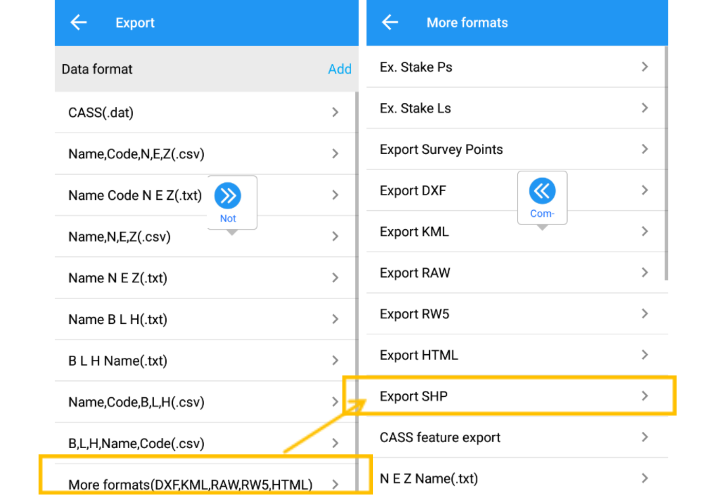
Fig. Export function in Survey Master
8 Prospects and industry applications
✓ Territorial survey:
P8H has been successfully used in forest survey and has broad application prospects in land survey. In addition, we have also envisioned some good application scenarios.
Food security is a global topic, and using P8H to survey and record cultivated land area, cultivated land type, crop varieties and yields can greatly facilitate government decision-making.
✓ Public service:
In areas with heavy rainfall in summer, urban flooding is prone to occur. When the water is deep, use P8H to find the location of sewer pipes, so that the water can be discharged in time.
When snow falls in winter in areas with large quantities of cold climates, road buildings are covered with snow. Use P8H to measure and find underground pipelines such as electric and gas pipelines, and conduct timely inspections and repairs to ensure the safety of citizens' life.
✓ Construction:
9 Summary
In summary, compared to traditional forest surveying methods, the P8H device offers greater portability and ensures measurement accuracy. Combining the highly portable P8H with laser measurement instruments and GIS surveying software allows for centimeter-level measurement accuracy, meeting the diverse needs of measuring various types of terrain and recording attribute elements. This significantly streamlines outdoor workflow, reduces fieldwork, enhances survey efficiency, and ensures the timeliness of GIS data.
As a crucial component of this forest surveying solution, the P8H plays a vital role. Its high-performance positioning capabilities ensure high precision in terrain measurement. Flexible communication methods and highly compatible device connection modes guarantee real-time data transmission with laser measurement devices, enabling individuals to quickly survey entire forests with simple operational procedures. The software offers a concise operational process, supports the addition and modification of attribute values in various formats, facilitating data visualization and real-time updates. The SBAS working scheme reduces reliance on RTK measurements, ensuring the acquisition of high-precision positioning information even in obstructed environments.
Beyond forest surveying, the P8H has extensive applications in GIS, including water resources, public services, electricity inspection, and surveying and mapping applications such as land surveying, cadastral surveying, engineering surveying, and construction. Therefore, it can be said that the P8H is the optimal choice for GIS surveying work.
TAKETANI(株式会社 竹谷商事)
Taking advantage of more than 50 years of information and manufacturing technology, TAKETANI is engaged in a business directly related to nature, developing, manufacturing and selling materials and machines that increase efficiency and reduce the burden on the earth's environment. Build solutions for the coexistence of nature and humans and contribute to society.
GEOSURF CORPORATION (ジオサーフ株式会社)
Since its founding in 2002, Geosurf has developed and delivered revolutionary ITC solutions that integrate positioning systems such as GNSS with spatial information.
GNSS network solutions have achieved impressive results in the construction of the Tokyo Sky Tree, the displacement monitoring of Haneda Airport, and the monitoring of major volcanoes in the country. Mobile GIS solutions can effectively collect and map GIS data in forest, agriculture and other fields.
About ComNav Technology
ComNav Technology develops and manufactures GNSS OEM boards and receivers for high precision positioning demanded applications. Its technology already been used in a wide range of applications such as surveying, construction, machine control, agriculture, intelligent transportation, precise timing, deformation monitoring, unmanned system. With a team dedicated for the GNSS technology, ComNav Technology is trying its best to supply reliable and competitive products to worldwide customers. ComNav Technology has been listed on the Shanghai Stock Exchange (Science and Technology Board), securities :ComNav Technology (Compass Navigation), Stock code: 688592.
About SinoGNSS®
SinoGNSS® is the official trademark of ComNav Technology Ltd., registered in People's Republic of China, EU, USA and Canada. All other trademarks are the property of their respective owners.
About ComNavTech®
ComNavTech® is the official trademark of ComNav Technology Ltd., registered in People's Republic of China, EU, USA and Canada. All other trademarks are the property of their respective owners.


