How to evaluate the quality of GNSS data?
Purpose
A GNSS module is a device that provides geolocation data by receiving signals from multiple satellites of GNSS constellation. The performance of signal acquisition and tracking directly determines PVT accuracy, so it is of great significance to evaluate the quality of GNSS data.
Method
// zero baseline test
Zero baseline test can eliminate or weaken satellite clock error, ionospheric error, tropospheric error, receiver error, antenna phase center deviation, etc. Therefore, the result of the zero baseline test is the internal noise of the GNSS module in signal acquisition and tracking, so the result of the zero baseline test can be used to evaluate the observation accuracy of the GNSS module. Connect A and B GNSS module to one antenna by splitter. After tracking satellites, record 30mins raw data and calculate carrier and pseudorange accuracy
- Pseudo-range accuracy
The calculation method is: use formula (1) to make a difference (single difference) between the pseudorange observations of the same satellite on module a and b; then use the formula (2) to make the difference between the two single-difference results of different satellites (double difference). Using formula (3), the pseudorange accuracy of a single satellite can be calculated. In the following formula, O is the pseudorange observation value, the superscript is the satellite number, the subscript is the module number, SD is the single-difference value, and DD is the double-difference value.
 (1)
(1)
 (2)
(2)
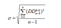 (3)
(3)
Normally, double-difference observations should be Gaussian with zero mean. And for a certain frequency, the receiver channel has consistency for acquisition and tracking. Therefore, a satellite with a higher cutoff angle and SNR can be used as a reference satellite, and the double difference of all satellites at this frequency can be calculated, and the pseudorange accuracy of this frequency can be expressed as formula (4)
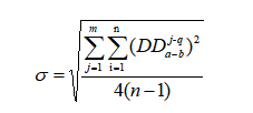 (4)
(4)
Among them, i is the epoch, j is the PRN number of the satellite, q is the PRN number of the reference satellite, and n is the number of double-difference observations.
- carrier phase accuracy
The carrier phase double-difference observations will have an integer ambiguity N. When the satellite is continuously tracked, the integer ambiguity remains unchanged. Differences are obtained to obtain three-difference observations to eliminate the influence of integer ambiguity, as shown in formula (5).
 (5)
(5)
The carrier phase accuracy of this frequency is
 (6)
(6)
In the formula, t1 and t2 are two adjacent epochs, and TD is the three-difference observation value.
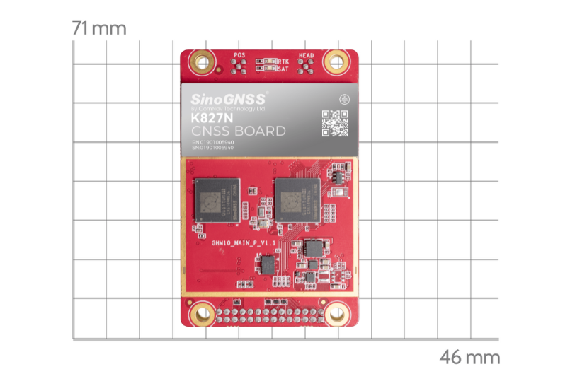
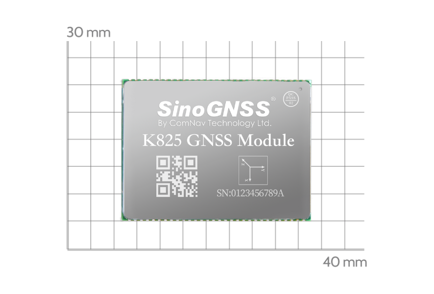
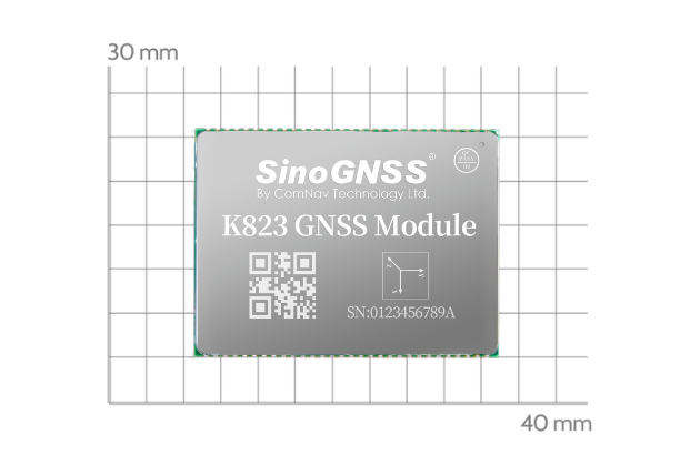
ComNav K8 series module adopt a new generation of SOC chip + AGC RF chip architecture, support full-constellations and multi-frequency signals, with low internal noise and high observation accuracy, it can provide users with highly reliable positioning information. The following table lists the carrier phase and pseudo-range accuracy of the K8 module.
Table 1. Observation accuracy of K8 module
Signal | K8 module | |
Pseudorange accuracy (m) | Carrier Accuracy (c) | |
L1 | 0.083 | 0.002 |
L2C | 0.094 | 0.005 |
G1C | 0.067 | 0.003 |
G2P | 0.055 | 0.003 |
B1I | 0.091 | 0.002 |
B3I | 0.021 | 0.002 |
E1c | 0.097 | 0.003 |
E5b | 0.039 | 0.002 |
// Raw data quality check
At present, the mainstream data quality check tools include TEQC, BNC, Anubis, etc. The following indicators are generally used.
——Signal-to-noise ratio (SNR)
Defined as the ratio of signal power to noise power, which can be used to indicate the quality of the signal. The larger the SNR value, the better the quality of the signal. In general, the RINEX file will directly give the SNR of the signal. The SNR is positively correlated with the satellite cutoff angle, and the higher the cutoff angle, the greater the SNR value.
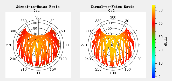
Figure 1 GPS SNR sky map of K8 module
——MP value
Pseudo-range multi-path, which can reflect the multi-path suppression capability of the module, generally the smaller, the better. The calculation method is:

The GPS multipath sky map of the K8 module.
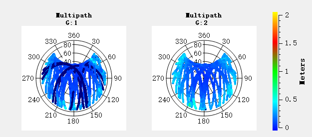
Figure 2 GPS multipath sky map of the K8 module
——Data integrity rate
The value of the effective actually observation by the module/the theoretical value calculated by the satellite ephemeris. The larger the value is, the more observation output by the board is, and the value should be 100% when module in open sky.
——Cycle slip ratio (O/SLPS)
The number of valid observations /the number of cycle slips ( 1 when cycle slips is 0).
If a satellite detects a cycle slip at two frequencies of a unit epoch, it is considered that the epoch has a cycle slip phenomenon. Generally, the combined method of MW and GF is used to detect and evaluate the cycle slip. The smaller the O/slips value, the more serious the cycle slip is.
cycle slip ratio is greater than 8000 in a non-interference environment.
Table 2 K8 module data quality check
BDS | GAL | GLO | GPS | |
Observation time (h) | 24 | 24 | 24 | 24 |
Data integrity rate (%) | 100 | 100 | 100 | 100 |
MP1 (m) | 0.16 | 0.29 | 0.29 | 0.18 |
MP2 (m) | 0.12 | 0.2 | 0.27 | 0.22 |
O/Slips | 1214246 | 236000 | 398990 | 488196 |
Average SNR1 | 45.22 | 43.66 | 47.96 | 44.32 |
Average SNR2 | 46.46 | 47.74 | 47.46 | 46.68 |
Total number of satellites | 32 | 21 | 19 | 30 |
summary
This article introduces the zero baseline test, as well as the quality check indicators of the GNSS observation data, which is convenient for users to quickly evaluate the GNSS module, and hope to be of some help to you.
About ComNav Technology
ComNav Technology develops and manufactures GNSS OEM boards and receivers for high precision positioning demanded applications. Its technology already been used in a wide range of applications such as surveying, construction, machine control, agriculture, intelligent transportation, precise timing, deformation monitoring, unmanned system. With a team dedicated for the GNSS technology, ComNav Technology is trying its best to supply reliable and competitive products to worldwide customers. ComNav Technology has been listed on the Shanghai Stock Exchange (Science and Technology Board), securities :ComNav Technology (Compass Navigation), Stock code: 688592.
About SinoGNSS®
SinoGNSS® is the official trademark of ComNav Technology Ltd., registered in People's Republic of China, EU, USA and Canada. All other trademarks are the property of their respective owners.
About ComNavTech®
ComNavTech® is the official trademark of ComNav Technology Ltd., registered in People's Republic of China, EU, USA and Canada. All other trademarks are the property of their respective owners.


